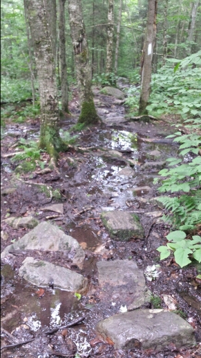
Today we started the hike with some more muddy trail under overcast skies. We hiked towards VT route 9 down a sharp descent and then promptly climbed back up from there. The weather stayed nice and clear and we saw it looks nice for the next few days here, so that was an instant morale boost. Then the trail got a bit nicer and less muddy on the north side of VT 9, which also helped boost the enthusiasm. The forests were nice and piney and much less of the swamp-like trails we had yesterday in northern Massachusetts and southern Vermont.
We didn’t have a lot of sights for most of the day, but it was pretty pleasant hiking and it went fast.
We hiked up to Glastenbury Mountain at the end of the day. The climb was easy. We saw a whole bunch of south bound thru-hikers today. Seeing them is a daily occurrence now. There are also a good number of people out here doing sections and weekend backpacking.
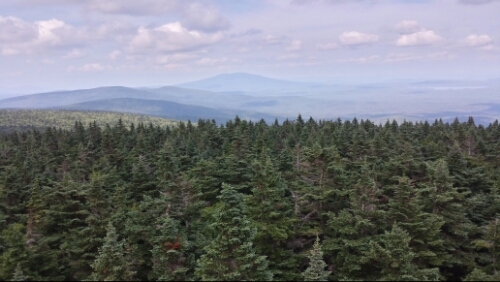
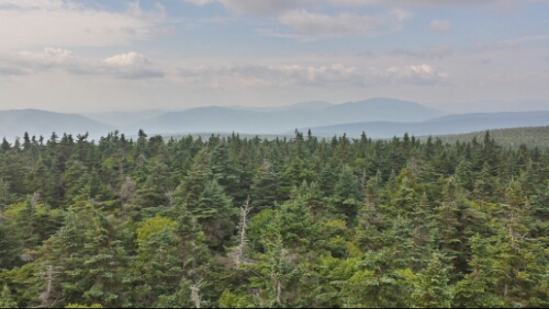
Anyway, Glastenbury is a really neat forest that reminds me of the high altitude forests in the Smokies. The air is crisp and invigorating and the trees are almost all pines. At the top of the mountain is a lookout tower with some excellent views. This is what I’ve been missing for a long while. It’s great to be back in this kind of scenery. It really makes for a nice payoff to the hard work.
We found a campsite about 100 yards from the tower. It’s pretty darn cold up here tonight since we are up near 4000 feet.
Vital stats for Saturday, August 2nd :
Miles hiked today – 16.7
Mood – awesome, still missing Musikfest a bit, but the nice hiking, great views, and good weather help immensely
Physical state – good
Smell – the cold, crisp air helps…a little
Song stuck in my head – 2 Chairs & 1 Tree by Brother


AAAs….Absolutely Awesome Adventure! And…Amazzing Appalachian Activity!
And…. Absolutely Alltruistic Action!
And….you need your AAA membership card for the hotel stay in Rutland!!
We were visiting SC and Mrs. E. She said to tell you she is proud of you two for this great hike! Over 1600 miles–YIPPEEEE! Your on the backstretch with still more amazing adventures to come. Live ya!
Awesome, thanks for relaying the message! Love ya too!
Wow ! When I look back and remember your backs disappear into the woods at the Springer Mtn. Approach in GA. The spring greening was just starting then at that elevation in April. I am amazed, awestruck and thankful for the generous sharing of your adventure. Truly the feat is physical, but much more is the determination and mental toughness it takes to master the less tasty parts of the journey . You are both masterful. Hurrah to you both. The summit of Katadihn is no longer shrouded in time and distance but now a brief three state walk away(ha,ha). Hep left, right, left. See you soon.
I second MomH’s comments…and we are soooo proud of both of you. When I started following your trek in the hiking book, my blue tab was at the top and now it’s nearing the bottom. I love moving it down the pages as your get closer to your goal. You have shared so much of your adventure with all of us. You do the work, and we enjoy the thrill without leaving our comfy homes. I guess we all owe you! 🙂 Stay safe and healthy. Sending more sneaker wings, cool ad pleasant Vermont thoughts, many prayers and lots and lots of love.
Don’t worry-I’m taking care of Musikfest for you!