Final stats & day in the life video

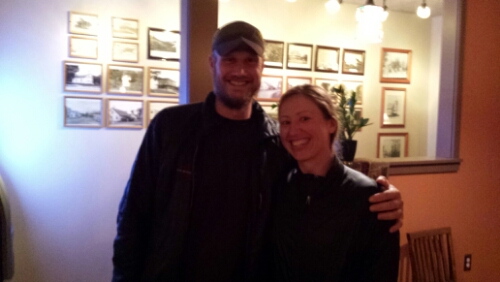
Merry Christmas / Happy Holidays / Happy New Year everyone! So it’s been over 3 months since we’ve finished our hike and we’re back to the “real” world. I’ve been a lazy bum about finishing this post as promised for no particular reason, but I finally did it. I’d like to give many thanks again to everyone who helped us out (our parents especially), sent us goodies, donated to our gofundme campaign, sent us well-wishes, and followed along in any capacity. I don’t think we could have done it without that support.

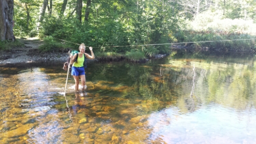
Anyway, here’s the day in the life video – apologies for the Blair Witch Project-esque jumpiness. Also, please be forewarned that I drop a few curse words in this.

This was filmed all in one day of hiking in New York on Friday, July 18th. Here’s the blog post from that day if you were interested.

And here are the “stats” –

Final stats :
# of miles hiked – 2185.3 plus a lot more to get water, to get into towns, to find campsites, to go to shelters, etc.
Start date – Wednesday, April 16, 2014
End date – Monday, September 15, 2014
# of total days – 153
# of hiking days – 132
# of full zero days taken – 21
Average miles hiked per hiking day (doesn’t include zero days) – 16.56
# of steps (approximately) – 5 million
Total pairs of sneakers used – 4 (Cowboy), 5 (Trippy)
# of states hiked – 14
# of bears seen – 12
# of campfires lit – 3 (usually too tired or hot to bother)
Favorite state – no contest – Maine (C, T)
Most challenging state – Maine (C), New Hampshire (T)
Most challenging section – no contest – Gorham, NH to Andover, ME (Mahoosuc range in western Maine) (C, T)
Favorite section in 2nd half – Rangeley, ME to Monson, ME (C, T)
Favorite overall section – Rangeley, ME to Monson, ME (C), tie between Rangeley, ME to Monson, ME and Hot Springs, NC to Damascus, VA (T)
Least favorite overall section – Duncannon, PA to Delaware Water Gap, PA (C), Massachusetts to Bennington, VT (T)
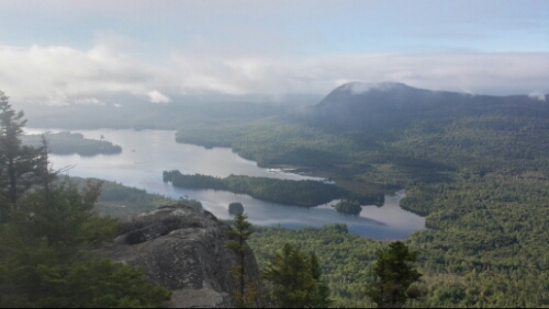
Best overall view – Avery Peak, ME (C, T)
Biggest surprise – amount of rock scrambling required in the Whites (C), New England terrain in general (T)
Biggest annoyance – bugs and water-logged trails (in Massachusetts) (C), mosquitos and descending sheer rock slabs in New England (T)
Favorite overall zero day town – Rangeley, ME (C, T) (Gorham, NH and North Woodstock, NH were close)
Favorite unplanned stop – Cornwall Bridge, CT (C, T)
Favorite 2nd half town we didn’t zero in but should have – Salisbury, CT (C, T)
Favorite overall town we didn’t zero in but should have – Front Royal, VA (C, T)
Best 2nd half accommodations – Autumn Breeze Motel North Woodstock, NH (C), Town and Lake Motel Rangeley, ME (T)
Best overall accommodations – Tree Streets Inn Waynesboro, VA (C), Hiker’s Inn Damascus, VA (T)
Worst overall accommodations – Uncle Johnnys Hostel Erwin, TN (C), Budget Inn Franklin, NC (T)
Hardest climb – Mahoosuc Arm, ME and Katahdin (C), Wildcat Peak E, Whites, NH (T)
Sorest 2nd half body part – knees (C), back and shoulders (T)
Food that we packed before the hike started that became the most unappealing – oatmeal (C), everything (T)
Grocery store food most craved – Mexican rice sides (C), Pop-Tarts and Velveeta shells and cheese with tuna (T)
Town food that was most craved – wings and beer (C), iced coffee (T)
Best breakfast – Little Red Hen, Andover, ME (C, T)
Best town meal – Forks in the Air Mountain Bistro, Rangeley, ME (C), SAaLT Pub, Gorham, NC (T)
Thing most missed about the trail – Relatively stress free living (C), Simplicity of life (T)
Thing least missed about the trail – Worrying about weather (C), Lack of toilet and bugs (T)
Would you do it again if asked immediately after finishing? – Maybe (C), No (T)
Would you do it again? – Yes (C, T)

For the fellow nerds out there, I made some graphs of our mileage hiking data.
Day 153 – Katahdin Stream Campground to Katahdin, Baxter Peak (mile 2185.3)

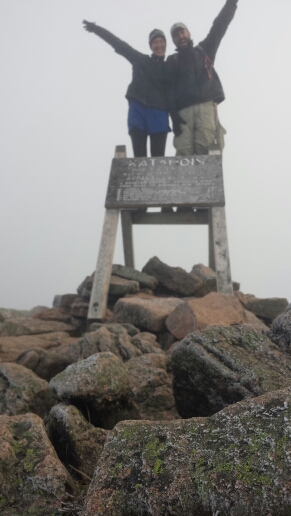
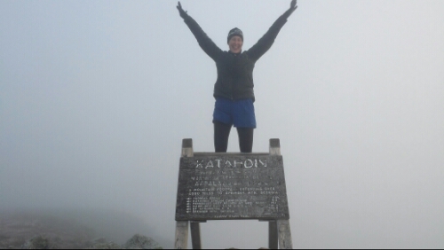
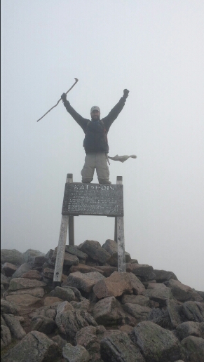
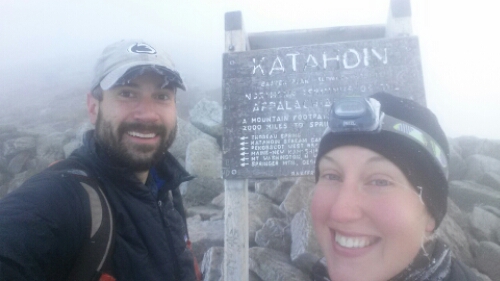
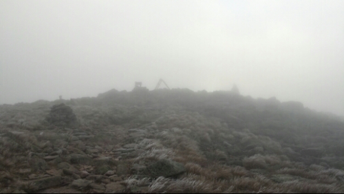
We finished our AT adventure today. We summitted the 5268 ft. Baxter Peak of Mount Katahdin this morning at 6:45am. It was a thrilling and unforgettable ride.

image

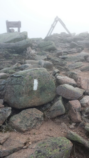
The "sign" in the distance

image

No one else was on the peak at 6:45am so I had to set the phone on a rock, set the 10 second timer, and carefully run over the icy rocks to get this blurry shot

image

image

image

Katahdin selfie!

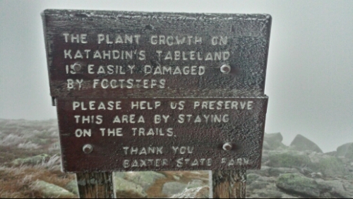
The emotions were running high. It was a mixture of immense joy, weirdness at being done, relief, a little bit of sadness, but mostly just pure excitement. We got up at 2:45am after not a ton of sleep in the lean-to. We made one last pot of not-so-delicious instant coffee, scarfed down some food, put our headlamps on, and hit the trail. We had 5.2 miles to finish the adventure. We signed in the trail register at 3:18am. The first couple miles were pretty nice and easy terrain, with some rock steps and fairly flat hiking. The next couple miles were a huge mess of boulders and rock scrambles to climb over. They were slow going and we had to be extra careful in the dark morning. We had a little bit of moonlight, but it clouded over as we got higher and higher. It also got colder and colder. We eventually climbed up over the boulder area to the Tablelands, a relatively flat area above treeline about 1.6 miles long that leads to the final summit. This area was windswept and insanely cold. It was like I’d imagine an Arctic Tundra to be like.

image

Ice crusted sign in the Tablelands

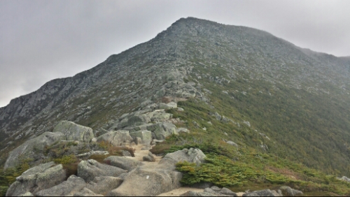
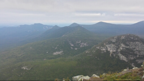
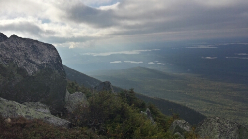
We pushed on as the light began to brighten the sky. Our hopes of catching the sunrise were out, as it was just way too cloudy up there for it, but it didn’t dampen our spirits. We pushed on to Thoreau Springs and had just one mile to go. The cold and wind intensified as we climbed the icy rocks. The last mile seemed to take forever, as I kept expecting to see the sign over and over. Once we crested the last ridge and it came in to view, I got some Maine dirt or something in my eyes because they were watering a bit and I went to the sign and screamed a raging girly scream of joy. It was an intense feeling that is just indescribable when it comes down to it. We took some photos for 5 or 10 minutes, but it was so cold that we didn’t want to linger. My fingers felt like they were going to fall off. We turned around and headed back down the 5.2 miles. We had some views in the morning light on the way down.

image

Looking down the ridge coming off Katahdin

image

Looking back up the boulder scramble area on Katahdin

image

image

We climbed back down and had to answer the question “what time did you leave this morning!?” about 10 times from day hikers. We got back down by around 10:15am. Packy and Tapey met us down in the lot and we celebrated with champagne and snacks. Thanks again for everything Mom and Dad! We departed Baxter State Park after a bit in a car. It’s weird to be going somewhere far in a car and not on foot. It’s a nice change for now. We’re both looking forward to some creature comforts like showers, toilets, good food, coffee, TV, etc. It’s the simple stuff like that that we don’t take for granted anymore, or at least for now.

I know sometime soon in the not so distant future though I’ll find myself thinking back on how fast this adventure went and wishing life were this simple again. Life is quite good when you get up every morning and your only responsibility is to hike somewhere new and beautiful and you  just have to follow the white blazes.

image

The last blaze on the trail. Sad.

So that concludes our lil’ walk. Thanks mucho to everyone for following along and for your love, support, comments, encouragement, well wishes, and the occasional piece of hate mail (j/k). It was really cool and unexpected that so many people checked this blog out. I had no idea. We got nearly 16,000 views since we started.

So that’s all, folks. At some point in the future, I’m going to post a recap with some “stats” and such and the “day in the life of a thru-hiker video” when I get around to editing it.

Otherwise, Adios, and good luck on your adventures. There was a quote all over the place on the AT in the south that I’m going to sign off with…

Go everywhere,
Study everything,
Fear nothing.

Vital stats for Monday, September 15th :
Milestone – finished the 2185.3 mile Appalachian Trail Thru-hike. Historically has over a 75% failure rate.
Miles hiked today – 5.2 (x 2 for the way back down).
Mood – happy, sad, excited, tired, weird, surreal
Physical state – very weary and tired, shoulders ache, back sore, neck sore, hands slightly bruised from bouldering, hips and surrounding joints sore, legs are tree trunks, knees feel shot to hell, bruises from falls, Achilles heel sore and feels slightly torn, heels sore, numb toes, toe joints feel screwed up, all tendons in feet screwed up, feet need to be replaced, thumbs tired from 153 blog posts on my phone, eyes bleeding. Aka thru-hiker normal.
Smell – pure pride and joy. J/k, brutally bad, I haven’t showered in a week!
Song stuck in my head – Started From The Bottom by Drake, Beautiful Day by U2

Day 152 – Rainbow Lake to Katahdin Stream Campground (mile 2180.1)

We got a lot of rain in our last night in the tarp. The tarp performed admirably yet again though and kept us nice and dry. We got up and were excited to get moving, as it was our last full hiking day. We hiked up to Rainbow Ledges above the lake and saw that Katahdin was shrouded in clouds today. That’s a bummer for the large group that climbed it today.

image

Clouds hiding Katahdin

I moved around until I got enough of a signal to check that Penn State won last night and then we hiked on. LET’S GO STATE!

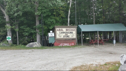
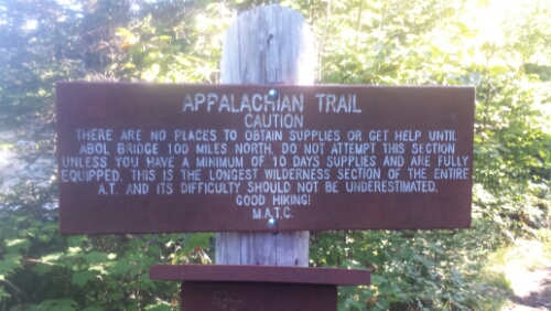
Most of the terrain was pure, good Maine trail. We hiked out of the 100 miles of wilderness right around lunch and then we stopped in the Abol Bridge Camp Store/Restaurant. We rocked a big lunch with Shellback, charged our phones up, and pushed on for our last 10 miles of trail (excluding that little 4000 ft. climb tomorrow).

image

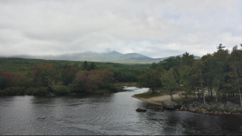
Big K still in the clouds around lunch at Abol Bridge

image

Mmm, real food after being in the wilderness for 5.5 days

The adrenaline started to pump for me this afternoon. The hiking was pretty easy as we stayed near the Penobscot River and then walked along some tributaries to the north. We entered Baxter State Park and hiked through it to Katahdin Stream Campground. We signed in at the ranger’s station and are hikers #505 and 506 to finish this year. Right when we left the station, we saw Ma and Pa Hnatow waiting for us. It was awesome to see them there. They brought us pizza and beer and we hung out at a picnic table with two other thru-hikers we met today, Viking and Patch. We hung out until it started to get dark and cold and then we made out way to the lean-to we reserved at the campground. We decided to reserve one ahead of time instead of take our chances at the small first-come first-serve thru-hiker site here, called The Birches. It turned out we would have been fine as there aren’t that many thru-hikers climbing tomorrow.

Our plan is to wake up at 2:30am, hit the trail at 3am, night hike up, and attempt to hit the summit by sunrise. It’s going to be freaking cold! I’m so pumped. It feels pretty weird to be writing one of the last daily blog posts. It’s been a lot of fun sharing these with friends, family, enemies, sheep, hackers, and Internet – enabled midgets. I suspect sleep is going to be difficult tonight, but that’s OK.

Vital stats for Sunday, September 14th :
Miles hiked today – 19.9
Mood – adrenaline pumping excitement
Physical state – ready to climb Mama K now
Smell – putrid moose corpse
Song stuck in my head – Lateralus by Tool

Day 151 – Tumbledown Dick Stream to Rainbow Lake (mile 2160.2)

We had a cold but peaceful night last night. We got up and started our second last full hiking day in the very chilly morning around 7am. It was a little sunny in the morning, but eventually clouded over and stayed gray and cold pretty much all day. We had mostly flat terrain except for a small climb up Nesuntabunt Mountain. We had more views of Katahdin from there, aka Mama K, aka Special K, aka Big K.

image

Big Special Mama Katahdin seen from Nesuntabunt

A lot of the trail today was evil Maine. We stayed by lakes almost all day, where there is often constant roots to hike over. We ate lunch at Crescent Pond.

image

Crescent Pond

The trail was really quiet today. We barely saw any other hikers. We think there is a bubble of hikers ahead of us that are all finishing either today or tomorrow. It was a pretty uneventful day overall.

We hiked around a lot of Rainbow Lake and made a stealth camp a couple hundred yards from the water rather than stay in the crummy looking campground a mile or two south. It started to rain just as we finished setting up. Hopefully this is the last rain we have to deal with out here.

Tomorrow we have almost exactly 20 miles to the Katahdin Stream campground, where we will make camp and then summit Monday morning.

Vital stats for Saturday, September 13th :
Miles hiked today – 20.5
Mood – ready to get to Katahdin tomorrow. Feels kind of surreal that it’s here.
Physical state – normal
Smell – rotten eggs on burnt toast covered in toejam
Song stuck in my head – Opale by Alcest

Day 150 – East Branch Lean-to to Tumbledown Dick Stream (mile 2139.7)

We had a few late night battles with a mouse, but overall we had a warm, dry spot near the lean-to. The rodents are particularly aggressive here in New England. What a pain. I tried to destroy this one a few times with my one croc, but failed miserably.

Anyway, we had a magnificent day for hiking. It started really cold this morning, especially putting on our damp clothes from yesterday, but as the morning progressed it turned into a perfect day for hiking. We climbed over Little Boardman Mountain, which was ridiculously easy compared the other mountains in Maine. After that, we had some of the best good Maine trail. We cruised at 3 mph or better for a lot of the day. This part of the Wilderness is really flat.

image

Typical trail today snaking past ponds and bogs

Most of the hiking stayed like that all day. We had a nice beach to snack on at Lower Jo-Mary Lake.

image

Afternoon snack at Lower Jo-Mary Lake

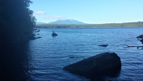
We kept cruising along and then hit the Pemadumcook Lake. I bushwacked down to the water and was greeted by this.

image

KATAHDIN!!!

What a fantastic sight to see. The picture does Katahdin no justice. She looms over the area and completely dominates the landscape. She just shimmers brilliantly in the light as she did in all my dreams. It was trail magic beyond belief.

We hiked on for a few more miles and made a stealth camp across the north bank of the Tumbledown Dick Stream. The weather is getting really cold! Good thing we’re almost done. Tomorrow looks mostly flat again with a small climb in the afternoon. We plan to hike within 20 miles or so of the campgrounds at the base of Katahdin.

Vital stats for Friday, September 12th :
Milestone – less than 50 miles to Katahdin, Katahdin in sight
Miles hiked today – 22.2
Mood – Excited to finish the journey.
Physical state – good, a little tired from the 20+ mile day, but nothing is going to stop us
Smell – mixture of rotten eggs, sour milk, and bad cheese
Song stuck in my head – Forest by Kaddisfly

Day 149 – Gulf Hagas Brook to East Branch Lean-to (mile 2117.5)

We woke up and headed out early today in hopes of beating some of the rain. It was misting and cloudy as we ascended up towards the Whitecap Range. We climbed up Gulf Hagas Mountain under some light rain and wind. It continued to sprinkle off and on as we made our way through the range. It was considerably easier hiking than yesterday, even with the precipitation. It was raw and cold though, so we didn’t really stop much and just pushed on quickly. We climbed Whitecap itself before lunch, which was a pretty easy climb with just a few minor rocks and roots to hike over. We hit a point though at the summit that was above treeline and it was just nuts up there. Do not go above treeline when it’s rainy and windy. This was similar to when we got caught in the Whites on Franconia Ridge in the storm. It was intensely gusty and sleeting sideways. Thankfully we only had maybe a tenth or two or mileage to traverse above treeline. The gusts were definitely stronger than the 60mph ones we faced in the Whites, as they really knocked us around and almost off our feet several times. It’s craziness how bad it gets. The other thing that was a bummer is that there is supposed to be our first view of Katahdin from up there. We had about 10 feet of visibility. We descended out of that nastiness and grabbed lunch at the nearest lean-to, then hiked on another 4 miles to the next lean-to and called it a day around 3. We dried out and relaxed under the tarp by reading, enjoying some hot chocolate, and napping. It was a good ending to a crappy day. The weather was so dreary all day I didn’t even take a single picture today.

Tomorrow we have a smoother looking day with nice weather predicted. Looking forward to some nice weather again for our last few days out here.

Vital stats for Thursday, September 11th :
Mountains remaining – 1
Miles hiked today – 14.1
Mood – good, dried out and relaxed
Physical state – normal
Smell – month old congealed beef ramen noodles
Song stuck in my head – Like A Rolling Stone by Bob Dylan, as covered by The Rolling Stones

Day 148 – near Long Pond Stream to Gulf Hagas Brook (mile 2103.4)

We had a nice, restful night in our site right off the stream. The white noise of the water was great to sleep by. The full moon really lit up the water and the rocks in it, too.

This morning we got up and began the climb into the Barren Mountain range. The first climb up to Barren Mountain had some nice views from Barren Slide.

image

The clouds blew out and it turned into a fabulous weather day for hiking. The bubble of northbound hikers is a day in front of us, so the trail seemed really empty again. The trail today was pretty much pure, uncut, evil Maine, however. It was everything that makes the trail here rough. That definitely made it slow going pretty much all day. By the time we got to our afternoon snack break we were beat. It was a great spot on Chairback Mountain, though.

image

Whitecap range off to the north

image

East Chairback Pond

From there we hiked down to the West Branch Pleasant River and forded it. We were originally going to stop there before the ford, but we saw the forecast for tomorrow looks pretty rainy, so we wanted to get the ford over today and make up some miles in case tomorrow is awful. We hiked on past the Gulf Hagas side loop trail and found a flat spot by the brook, so we have some nice water white noise again. We’ve been leapfrogging another hiker from Pittsburgh named Shellback who camped down near us.

Tomorrow we head over the Whitecap range, the last significant mountains before Katahdin itself.

Vital stats for Wednesday, September 10th :
Milestone – less than 100 miles to Katahdin and over 2100 miles hiked
Mountains remaining – 2
Miles hiked today – 18.2
Mood – not excited about the 90% chance of rain tomorrow, but otherwise very excited
Smell – still not too bad, it was very cool again today
Physical state – pretty tired after so much evil Maine
Song stuck in my head – Wildflowers by Tom Petty

Day 147 – ME 15 to near Long Pond Stream (mile 2085.2)

After breakfast in town, we got shuttled back to the trailhead by Tim (aka Prince) from Lakeshore. Cool dude, he totally looks like the musician formerly known as Prince. We promptly entered the Wilderness.

image

Warnings! We have about 5.5 days of food!

Most of the hiking today was uneventful actually. We hiked by a few ponds and bogs and had 3 streams to ford. The biggest ford was thigh deep, so that was interesting. Also, there was a moose carcass on the other side of it, so in a sick sort of way we saw a moose. Not what I was hoping for!

We passed by a few falls and stayed near water most of the day. It was pretty quiet on the trail. No big views today, either. A lot of the terrain was choppy evil Maine with a lot of small ups and downs.

image

We stopped fairly early because we hit our mileage goal and don’t really have any reason to push bigger miles. We found a nice campsite just off the trail right on the Long Pond Stream a bit past the ford. Tomorrow we have the Barren Mountain range to hike over, so it should be more eventful.

Vital stats for Tuesday, September 9th :
Miles hiked today – 14.4
Mood – good
Physical state – normal
Smell – day 1 of 6 in the Wilderness, it was cooler today, so not bad yet
Song stuck in my head – Sugar, We’re Goin’ Down by Fall Out Boy

Day 146 – Monson, ME

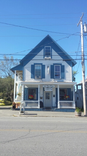
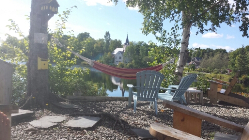
We spent our last zero day hanging out near the Lakeshore Lodge most of the day. We sorted through our resupply and did a few errands, but mostly just hung out and relaxed. The pub was closed, but we were allowed to hang out on their back patio on Lake Hebron and sip some adult beverages. The weather was fantastic.

image

Lakeshore Lodge and Pub

image

Lakeshore back patio

image

Not the beach, but pretty awesome

image

Bustling metropolis of Monson

All in all, it was a very relaxing final zero day. Tomorrow, bright and early, we head into the final stretch of trail. This section is called the 100 miles of wilderness. It is the longest section of trail without any towns or even any real roads. We are planning to hike for 6 days to get to Baxter State Park, the home of Mount Katahdin. So barring any major disasters, we plan to summit Katahdin and finish our hike next Monday morning. I’m not sure if we will have any cell data in the 100 miles, so there may be some radio silence from the blog for a few days. So if there are no updates this week don’t be concerned, either we have no cell coverage (or I decided to try to ride a moose there).

Day 145 – Moxie Bald Mountain Lean-to to ME 15 (mile 2070.8, Monson, ME)

Last night the loons were making their loony noises for a while. It was a really neat sound to hear them with the breeze blowing through spruce fir trees. It was another one of those magical Maine moments.

We got up pretty early to get to town a bit earlier. I was scoping the pond out before 6am in hopes of a moose sighting, but no luck, just a few of those crazy loons floating around. The sunrise came up and exploded gloriously over the pond though, so it was still awesome.

image

image

image

So cool. Ok Maine, you already won my “most scenic state” award, there is no contest.

We hiked today over alternately good and evil Maine trail. We had 3 fords today. Trippy took her shoes off and forded all 3 in her crocs. I rock and root hopped 2 of the 3, which mostly just got my feet wet. She is much smarter than I am.

image

Taking the ford the smart way

We were able to move pretty fast throughout and we got to the trailhead at ME 15 by 3:30pm or so. We got a shuttle from the Lakeshore Lodge where we are staying quickly. Monson is tiny, but seems pretty cool. The Lakeshore has a pub attached where we grabbed dinner with our trail doppelgangers Z and Gia. We did both our 1000 and 2000 mile days on the same day, so it was great to catch up and have some beers and try to figure out where we can do trail magic someday somewhere between PA and Kentucky where they live.

image

Z and Gia

We also got our 15th and last maildrop from Packy and Tapey today (it was actually more like 17 or 18 drops I think!). Thank you guys so much for all the logistical support on this adventure! We also got the bonus goodies from Aunt Linda and Uncle Mike – thanks a million. It’s been awesome to have so much support out here from friends and family.

Tomorrow is our last zero day on the trail. It’s already a little bittersweet for me. We are really excited to finally finish and come home, but I know I’ll miss this amazing adventure real soon.

Vital stats for Sunday, September 7th :
Miles hiked today – 17.9
Mood – awesome
Physical state – tired, but resting up for the last week out here
Smell – like a fresh Maine pond
Song stuck in my head – Don’t Stop Believing by Journey