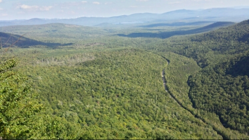
Day 144 – US 201 to Moxie Bald Mountain Lean-to (mile 2052.9)

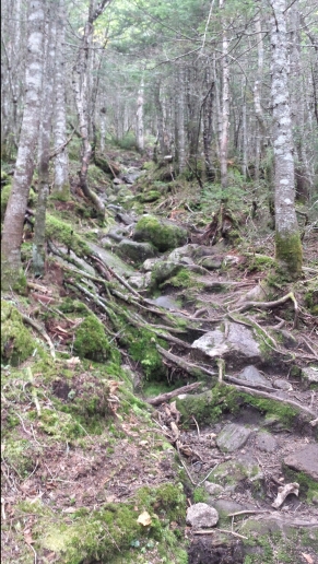
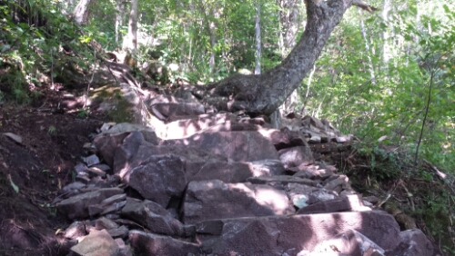
We had a really quality continental breakfast at the Sterling Inn. Shortly after, Eric from the Inn shuttled us and a few other hikers back to the trail around 7:45am. It was easy going trail for quite a while as it gently ascended to Pleasant Pond Mountain. I started to refer to this kind of normal and flat trail as “good Maine” vs. “evil Maine”, where the trail is gnarly and filled with crazy roots, rocks, and PUDS. The weather was holding out for the morning, although it was crazy humid and sweaty. We climbed Pleasant Pond Mountain and had some clouds coming in by the time we reached the summit.
image

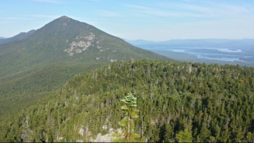
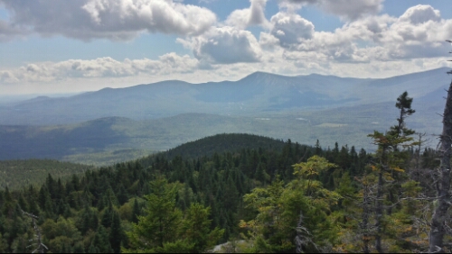
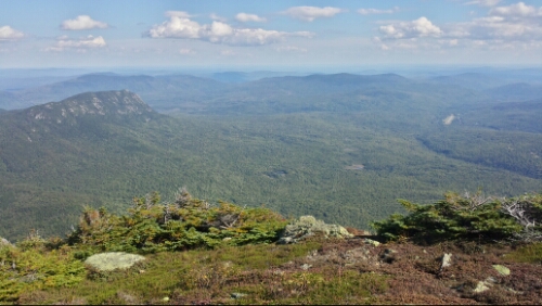
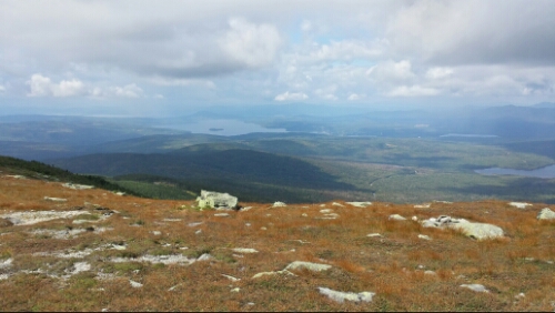
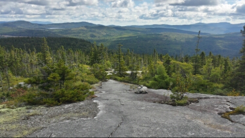
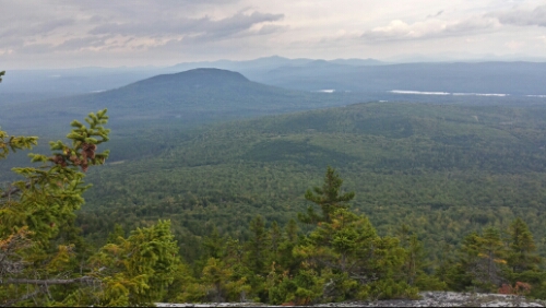
View North on Pleasant Pond Mountain. I think that's the Barren Mountain range out in the distance, one of our last.

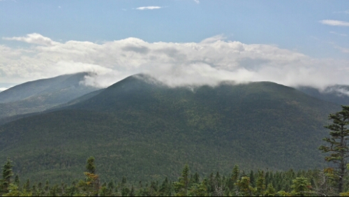
We descended and hiked for 5 miles or so more on evil Maine terrain to the south outlet of Moxie Pond, which was another supposed ford. Again though, the water was low enough for us to hop across the rocks without getting wet. We hiked on and the skies grew more ominous. We got to the Bald Mountain Lean-to and things looked really imminent for a storm, so we hustled under the shelter as it started to rain. I think this was the first time on our entire hike that we got lucky enough to be near a shelter just as it started to pour. We hung out and chatted with a south-bounder until it stopped 20 minutes later or so. We then climbed over Moxie Bald Mountain in a misty cloud. It was another fairly easy climb, with mostly good Maine going on.

image

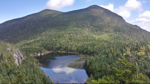
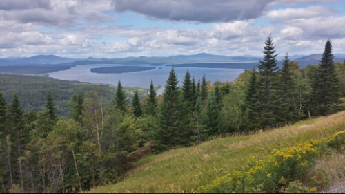
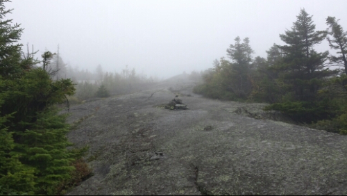
Misty approach to the summit of Moxie Bald

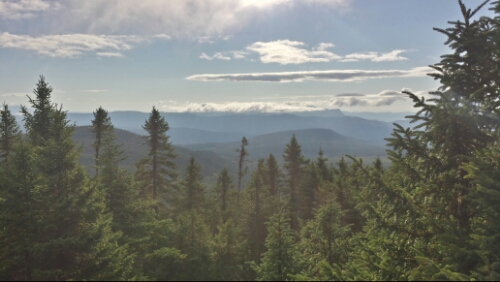
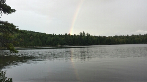
We hiked down to the Moxie Bald lean-to, which is on the Bald Mountain Pond, and found a tent site just off the pond. We had some light drizzle as we ate dinner under the tarp, but it blew out and a sweet (and almost double) rainbow popped out across the pond.

image

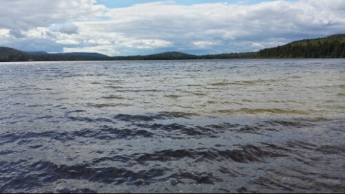
Rainbow over Bald Mountain Pond

The weather really cooled down, which is great for hiking tomorrow. We have around 17 miles into Monson, the last town on the trail. Wow.

Vital stats for Saturday, September 6th :
Mountains remaining – 3
Miles hiked today – 18.8
Mood – great, other than lack of moose
Physical state – Maine normal
Smell – oozing Moxie…or something like that
Song stuck in my head – Hail To The Lion by The Pennsylvania State University Marching Blue Band (first thing I did when we got to the top of Moxie Bald was to check my phone signal to see what the final score of the Akron game was.)
Day 143 – East Carry Pond to US 201 (mile 2034.1, Caratunk, ME)

We left the pond and our nice site around 7:30am today and headed towards Caratunk. The sunrise on the pond was cool.

image

Sun coming up over East Carry Pond

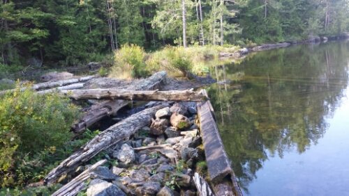
The elevation profile on our guide today looked very flat and tame compared to most other days in Maine. The first 6 miles or so to the Pierce Pond lean-to were quite easy and flat (for Maine). We got there and took a long snack break. We knew we had some time to kill because we had to get a ferry to cross the Kennebec River. It runs between 9-11am and 2-4pm and we knew we wouldn’t make the morning ferry. We hung out a bit at the lean-to and then made our way across the wooden dam there. That was kind of weird, who makes a dam out of wood, other than beavers?

image

Non-beaver wooden dam on Pierce Pond

The trail after there still looked flat for 4 miles or so, but it went back to standard difficult Maine terrain, with lots of small ups and downs, rocks, and roots to deal with. By that time, it was pretty hot out and it felt like summer again. We got to the river around noon and were first in line for the 2pm ferry. We ate lunch and lounged around by the river waiting. The “ferry” is a guide in a canoe which is the officially sanctioned way to cross the river because it’s too dangerous to ford due to highly variable water depth because of a hydroelectric plant / dam up the river. It certainly looked like it would have been dangerous to ford as the current was clearly powerful.

image

Looking across the Kennebec to the trail on the other side

We hopped aboard the canoe with the guide and I helped paddle while Trippy took pictures and sat in the middle. The canoe floor actually even has a white blaze on it.

image

Paddling the canoe

After that, we had a short hike to get to the Sterling Inn in Caratunk. A friendly local gave us a ride there to save a bit of road walk. We resupplied and also got a shuttle up to the Northern Outdoors compound a couple miles up the road for drinks and dinner. The compound includes the Kennebec River Pub, which makes some tasty brew.

Tomorrow we are back on the trail and headed towards Monson. We have some bad weather forecasted here, but we are planning to hike through it at this point.

Vital stats for Friday, September 5th :
Miles hiked today – 10.3
Mood – good
Physical state – normal
Smell – aight
Song stuck in my head – Chocolate by The 1975

Day 142 – Safford Notch Campsite to East Carry Pond (mile 2023.8)

We had a pretty nice campsite last night at Safford Notch, but the chipmunks there were insane little beasts. We hung our food bags, but they climbed down the slick rope and gnawed multiple holes in both our bags and ate a little of our chocolate and some trash. If I can catch any of those cute little rodents, they are going in the cook pot as some delicious and cute extra protein.

Anyway, besides the chipmunks, we had a really nice day. We first hiked up the gradual and somewhat tough climb to Little Bigelow Mountain.

image

Avery Peak, as seen from Little Bigelow. Flagstaff Lake to right.

Then we descended down to the lean-to (aka shelter) and had a morning snack. The trail got easier as we went down and eventually even resembled an actual recognizable walking path. It’s a strange concept after hiking the Whites and Maine. We crossed East Flagstaff Road and then got flagged down by some older dudes in the parking lot who had a crazy trail magic spread. Score!

image

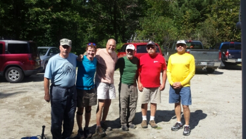
The dudes are all thru-hikers, the lady is a thru-hiker named Red Robin who we've been playing leapfrog with since Virginia

They gave us some breakfast sandwiches (it was brunch-ish or so), drinks, snacks, etc. We hung out long enough that they fired up the grill for lunch and we had some delicious cheeseburgers. Some of them are trail maintainers in Maine now, so that was really cool to here their stories and chat with them.

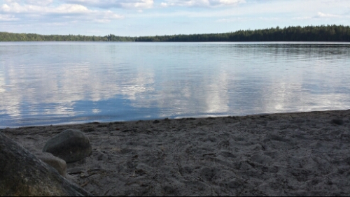
After we took our leave, we hiked on over fairly easy trail for the afternoon. We went by West Carry Pond, which looked dreamy, but it felt too early to stop. There was more trail magic at the lean-to there. Someone made cereal bars, like rice crispy treats, but with various sugary cereals instead of puffed rice…amazingly good. We pushed on for another 4 miles or so and got to East Carry Pond, which is equally as dreamy as the other directional Carry Pond . We found a fantastic site just off the pond. I really don’t know why they are called ponds though, these things are huge and would certainly be called a lake in Pennsylvania. We waded in the clear water near the sandy beach and relaxed. It was very nice to have a relaxing and pretty easy hiking day.

image

Sandy beach at East Carry Pond

I sat quietly by the pond at sunset writing most of this post waiting for a moose to wade in to the water, but no luck there unfortunately. The colors of the sunset were beautiful though.

image

Sunset on the pond with the moon

Tomorrow we’ve got about 10 miles or so to hit the tiny town of Caratunk, where we are stopping for a nearo and to resupply for the short push this weekend to Monson, the last town on the trail.

Vital stats for Thursday, September 4th :
Miles hiked today – 16.3
Mood – really good, so nice to have an easier day, get some great trail magic, and find a fantastic camping spot
Physical state – still tired overall, but the easier day helped a lot
Smell – unshowered moose
Song stuck in my head – mash-up of 2 Legit 2 Quit by Hammer (complete with hand motions), The Weight of Living by Bastille, and Burn Pile by Moving Mountains (by far the weirdest mash-up I’ve had on the trail)

Day 141 – mile 1994 to Safford Notch Campsite (mile 2007.5)

We had a lot of rain last night, so everything was super humid this morning. We stayed dry though. We lingered a bit late in the tarp this morning as the wind blew cold, raw air around us. Eventually, we hiked down towards Maine 27, the road that goes to the town of Stratton. It was slow hiking to get there, as the trail was very rooty and slick. We then started the long and challenging climb up to the Bigelow Range. The climb to get up to the range was pretty slow and rocky. We passed this guy near the way up. It was technically about a mile off from where our guide claimed it should be, but whatever, close enough!

image

We've hiked a couple miles this summer

There were some nice views of Horns Pond and the North and South Horn peaks from the ridge.

image

The Horns - Pond, North, and South. Sadly, no Bill and Bridget

We climbed South Horn, which was a steep rocky half mile.

image

View from South Horn

Then we descended and climbed back up to the open ridge of Bigelow West Peak. The views were outstanding.

image

Trippy climbing Bigelow West with the Horns in the background

Next up was a brief descent and climb right back up to the Bigelow Avery Peak, which had even more amazing views.

image

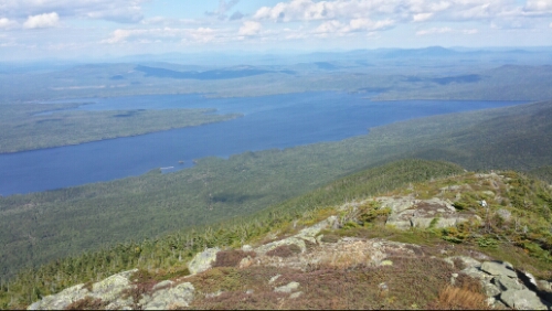
Flagstaff Lake from Avery Peak

image

Little Bigelow Mountain on left in foreground. Other endless mountains from Avery Peak

The weather was fantastic and the scenery was spectacular. We took a long snack break just sitting and marvelling at these views from Avery Peak. It’s very challenging here in Maine, but the reward for the hard work is awesome.

We then climbed down the steep 2 mile descent to the giant boulders down in Safford Notch. We hiked the extra 3/10 of a mile to the campsite here and called it a day around 5pm. Tomorrow we climb off the Bigelow Range. We also have no major mountains tomorrow, which is actually a nice break since these last 3 days have been tough.

Vital stats for Wednesday, September 3rd :
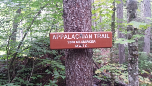
Milestone – we are officially 2000 milers
Mountains remaining – 5
Miles hiked today – 13.5
Mood – great
Physical state – same – tired, but ok
Smell – huge, terrible moose
Song stuck in my head – Dear Avery by The Decemberists

Day 140 – Sluice Brook to mile 1994

We headed out this morning and almost immediately began our first climb. We hiked up to Lone Mountain. It was a pretty steep climb, but the trail wasn’t too bad. I think we almost went up too fast and tired ourselves out a bit because the tread was pretty smooth compared to the normal crazy rock and root party that Maine throws. We got to the top, but the actual summit and viewpoint was another 150 yards up a pretty nasty looking chute of rocks, so we skipped it. We were trying to get over the 4000 footers before all the thunderstorms that were predicted hit us by late afternoon, also. We hiked along and then had our second big climb up and over the northwest corner of Spaulding Mountain. It was another pretty tough one. Then the descent down off this ridge was wickedly steep. It took quite a while to get down to the South Branch Carrabassett River at the bottom. There were a few hawks sailing seemingly around our heads as we climbed down the precarious rocks.

image

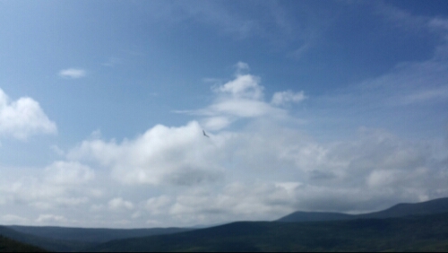
Hawk sailing around

image

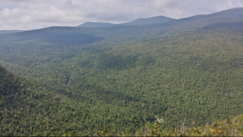
Valley between Sugarloaf and Crockers

This river was the 3rd one that can require a ford, but all of them have been low enough that we could rock hop across without getting wet so far. I think there are a few farther north that we won’t be able to avoid fording, however. After we ate lunch by the river, we started the long 2000+ feet, 2+ mile climb up to the Crocker Range. The climb started pretty easily, but then after a campsite junction it got intensely steep. It levelled a bit off after a half mile or so, but the remaining half mile seemed to just go on forever. Once we hit the summit, the clouds had overtaken all the views, too. A storm seemed imminent, but it held out and then actually got nice and sunny later in the day. We climbed over North Crocker and then down off the ridge. We found an established campsite on the way down and grabbed it.

It was another really tough day here in Maine. Our legs are just super beat after all the constant elevation change since we hit the Whites. Tomorrow looks to be another pretty tough day with the Bigelow Range looming, but after that we should have a bit of an easier stretch as we head towards the town of Caratunk later this week.

Vital stats for Tuesday, September 2nd :
Milestone – less than 200 miles to Katahdin
Mountains remaining – 6
Miles hiked today – 14.9
Mood – feeling excited about having less than 200 miles left
Physical state – tired, but good otherwise
Smell – the moose are avoiding me now (come on you moose, I just want to see one of you!!)
Song stuck in my head – Go Do by Jónsi

Day 139 – ME 4 to Sluice Brook (mile 1979.1)

We decided it was finally time to depart Rangeley this morning after breakfast. We quickly got a hitch out of town from a nice local guy who was really into all the various hunting seasons they have up here, including the lottery-based moose hunt. We were hiking a little before 9am. We had some pretty big mountain climbs today going over Saddleback, The Horn, and Saddleback Junior. The climb to Saddleback was very root-filled and slow until we got up above treeline. Once we got up there, we had multiple false summits, but it was pretty nice hiking so we didn’t mind.

image

One of the false summits of Saddleback (that area on top is not the summit)

image

Rangeley Lake off in the distance from Saddleback summit

We then hiked down some steep and slick trail and then back up to The Horn. We grabbed some lunch and chatted with some other thru-hikers up there. We got a bit of rain shortly after that as we descended The Horn and ascended the last of the 3 peaks on this range, Saddleback Junior. By the time we summited, the rain had blown out and it was sunny again. The clouds were blowing through fast all day.

image

Clouds covering Saddleback and The Horn as seen from Saddleback Junior

A lot of the trail was tricky today, with loads of wet roots and rocks to contend with.

image

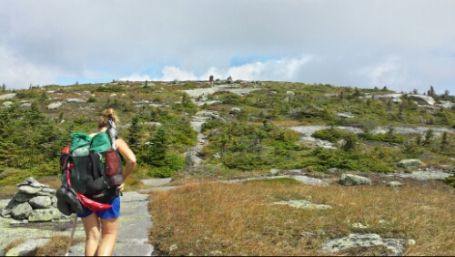
Typical gnarly Maine trail

We hiked down off that ridge and then briefly back up the next ridge and then found a little stealth spot off the Sluice Brook. Tomorrow we have the fairly large Spaulding/Sugarloaf/Crocker range to tackle.

Vital stats for Monday, September 1st :
Mountains remaining – 9
Miles hiked today – 14.2
Mood – good, glad to be back on the trail and heading towards the goal again
Physical state – improved after 2 days off, but still tired from another tough Maine day
Smell – sweaty moose
Song stuck in my head – Elderly Woman Behind The Counter In A Small Town by Pearl Jam

Days 137 & 138 – Rangeley, ME

We had a good zero day Saturday. ESPN2 didn’t work at the motel, but I got to follow the PSU game on my phone and celebrate the dramatic win nonetheless. WE ARE!!

We did a little canoeing on the lake and hung out at the small hiker festival they had in town.

image

Seaplane taking off on Rangeley Lake

The weather was predicted to be pretty bad with thunder and lightning, so we decided to take off and rest for an extra day on Sunday, too. The next section of trail has a good bit of above-treeline hiking, so we weren’t overly keen on heading back out in storms.

This is a great little town to take our first (and probably only) “double-zero” day. It’s definitely winding down from summer tourist season though. Tomorrow morning we are heading back to the trail to continue trekking through Maine.

Day 136 – near Little Swift River Pond to ME 4 (mile 1964.9)

We had a short and easy hike today down towards the road. We passed by a few ponds and bogs and got there by 9:30am or so. We got an easy and quick hitch into town from some friendly locals. They gave us some good insider information about the town. Rangeley is about 9 miles from the trailhead and seems like a cool little tourist town. We got to our room at the Town and Lake Motel, checked in early, and then did our errands. We have a back door on our room that leads out to Lake Rangeley.

image

Google made this automatically awesome

Seems like a great zero day town.

Vital stats for Friday, August 29th :
Miles hiked today – 4.5
Mood – really enjoying these last zero days in cool towns
Physical state – resting up, feeling pretty run down at this point in the trip
Smell – moose in a fresh, clean lake
Song stuck in my head – Amnesia by Justin Timberlake

Day 135 – unnamed gap to near Little Swift River Pond (mile 1960.4)

We had a few sprinkles of rain last night, but nothing bad. The weather was cold, windy, and overcast most of the day, with bits of sun poking through occasionally.

image

Morning light near Bemis Mountain

We hiked up the small climb to Bemis and Bemis Second Peak. The second Peak had cool views.

image

Bemis Mountain 2nd Peak

Most of the hiking was pretty easy for Maine (which is still pretty hard), with minor ups and downs, roots, and rocks to contend with, but no major obstacles. We climbed up and crossed route 17 at lunch, with spectacular views of Mooselookmeguntic Lake (no, I did not make that name up).

image

Maine has been so beautiful so far. Even on a day without any major mountains, there is amazing stuff seemingly everywhere. We took an afternoon snack at Maxie Pond, which had a little sandy beach.

image

Maxie Pond, bigger waves than Delaware Bay / Lewes

I waded out into it for a bit and it was freezing. It feels like fall up here already. Some leaves are turning red on some trees already, too.

We hiked to the campsite at Little Swift River Pond, but it’s a popular spot and thus was pretty full, so we hiked on for a bit longer and found a stealth site in the woods instead.

Tomorrow we have a short day to get to Rangeley. We are taking a zero there to rest from the super difficult mountains of western Maine. This should be our second last zero day. We also suspect this will be the last town of any decent size that we encounter on the trail.

Vital stats for Thursday, August 28th :
Miles hiked today – 17.5
Mood – good, ready for town tomorrow
Physical state – feet and knees feeling it from the constant rocks, roots, and elevation change
Smell – medium-sized moose
Song stuck in my head – Moments in a Life by Water & Bodies

Day 134 – East B Hill Road to unnamed gap (mile 1942.9)

We hit up breakfast at the one restaurant in town this morning, the Little Red Hen. It was fantastic. They had a huge hiker breakfast for $10 including 3 huge pancakes, 3 eggs, a homemade English muffin, home fries, bacon, and sausage. I’m going to miss being such a glutton.

image

Part of breakfast. Note pile of empty butter to add more calories to meal.

After that, we got the shuttle back to the trail around 9:15. We had a long slow climb up to Wyman Mountain that was pretty easy. Then we had a steep descent down to Sawyer Notch, promptly followed by an extremely steep climb up Moody Mountain. Shortly after, Moody had another steep descent down to South Arm Road. Most of the climbs today though were on fairly reasonable trail, so it wasn’t as bad as Mahoosuc Monday. We had a nearly 3 mile climb following that up Old Blue Mountain. It was steady, but not too bad and again had mostly smooth trail, for New England at least.

image

Stone steps going up Old Blue

image

View from part of Old Blue climb

We descended down from there and found a nice established site not far off the trail. Overall, it was a really pleasant and temperate day for hiking.

It’s super quiet here in this spruce fir forest. Tomorrow we continue hiking toward the next town, Rangeley. Surprisingly, we have no major mountains to climb tomorrow…bummer.

Vital stats for Wednesday, August 27th :
Mountains remaining – 10 (I’m only counting 1000 feet or more in elevation)
Miles hiked today – 14.5
Mood – great
Physical state – good
Smell – small moose
Song stuck in my head – Sol Solis by Moving Mountains