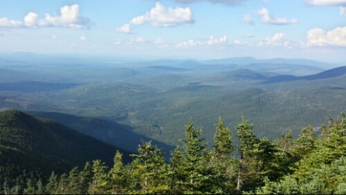
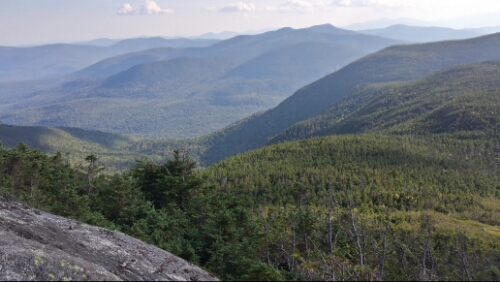
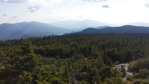
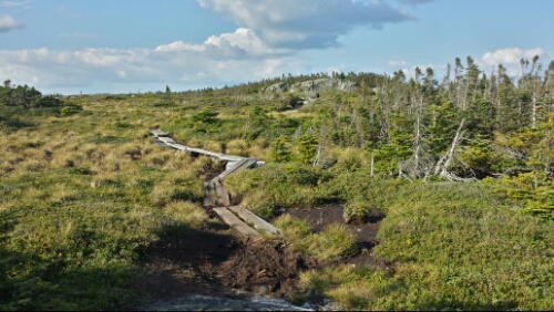
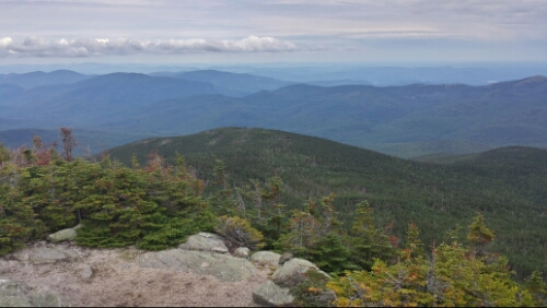
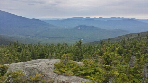
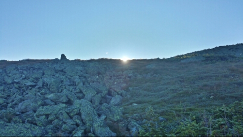
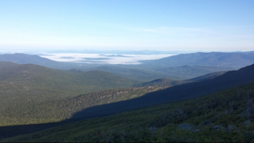
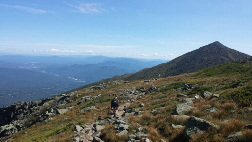
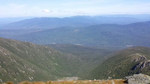
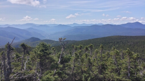
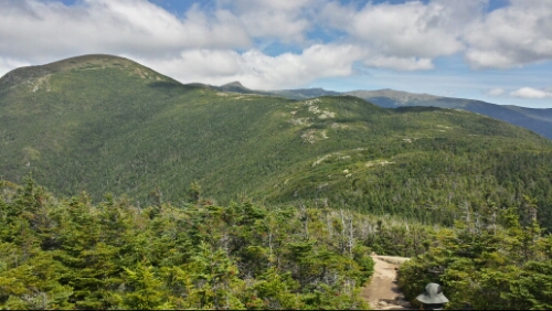
Author Archives: Joel

Day 133 – near Grafton Notch to East B Hill Road (mile 1928.4, Andover, ME)

We had a super clear night last night. The stars were in full effect with very little light pollution. Very cool to see so so many stars visible.

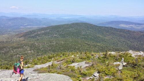
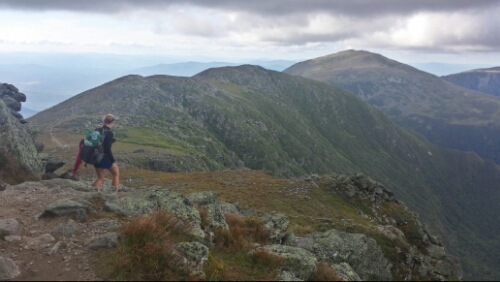
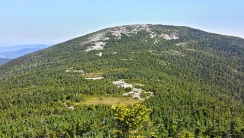
Today we hiked down to Grafton Notch and crossed Route 26 in Maine. Then we climbed up the first part of the climb towards the West Baldpate Peak. The first climb up to the lean-to (aka shelter in most other states) wasn’t bad, but the last 8/10ths of a mile from there to the summit was steep as usual. They built a ton of rock steps in the trail though, so it didn’t require any scrambling or boulder hopping. We took a break on the breezy summit and chatted with some “adventurers” (what they called themselves) named Pyro and Na-Uh who have hiked a bit over a thousand miles and then “yellow-blazed” (aka hitch hiked) the rest of the trail. They were interesting folks and had some good stories. Anyway, the view was cool from West Baldpate and we could see the upcoming East Baldpate climb.

image

East Baldpate as seen from West Baldpate

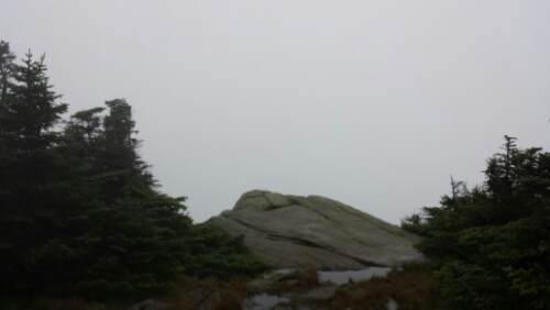
We climbed down between the peaks and then went up that exposed granite rock area visible in the picture above.

image

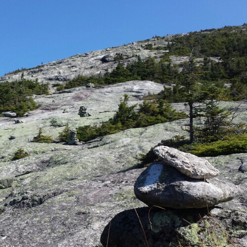
Climb up East Baldpate

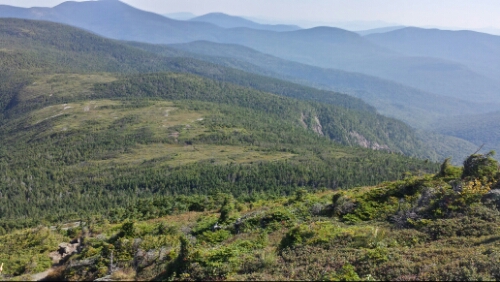
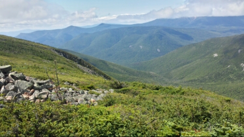
This climb was seriously awesome. It was way steep on that rock, but the views were superb and it was amazingly cool to be out on that open rock the whole time. It would have been miserable and slow if it had rained or been wet, but thankfully it was sunny and dry all day.

image

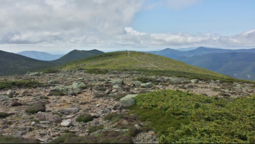
Views off East Baldpate

The descent down was another crazy steep and slick rock slab climb. It wasn’t too long though and shortly after it graded out pretty nicely. We ran into a crew doing some heavy duty trail maintenance and they told us they are trying to reduce some of the insanely dangerous slick rock slabs that this section of Maine is notorious for with rock steps.

The rest of the 4 miles or so of hiking were actually the easiest consecutive miles we’ve had since probably somewhere in Vermont. We got to East B Hill Road and waited with Pyro and Na-uh for the shuttle from the Pine Ellis Lodge in Andover.

Andover is a tiny little town with a general store with an attached diner, a microscopic grocery store (also with diner) that looks just like the general store, and one restaurant that closes at 2pm most days. We did our resupply, ate a lot of food at the attached diners, and relaxed for a chunk of the afternoon and evening. Tomorrow morning we head back to the trail for a few more fun climbs. We’ve read online that the section we just finished from Gorham, NH to Andover, ME is generally considered the toughest on the entire AT and we are hoping that’s true, but you never know out here.

Vital stats for Tuesday, August 26th :
Miles hiked today – 11.1
Mood – good, can’t take these days for granite
Physical state – tired
Smell – as good as it gets
Song stuck in my head – Stubborn Love by The Lumineers
Day 132 – Carlo Col Shelter to near Grafton Notch (mile 1917.3)

Belated thanks to Adam/Sabrina and Aunt Linda for the goodies in Gorham!

After a good night of sleep, we hit the trail knowing it was going to be a tough day. It was tough indeed. We had some choppy up and down climbs with occasional scrambles getting over Mount Carlo and the Goose Eye west, east, and north peaks. We popped up above the tree line numerous times.

image

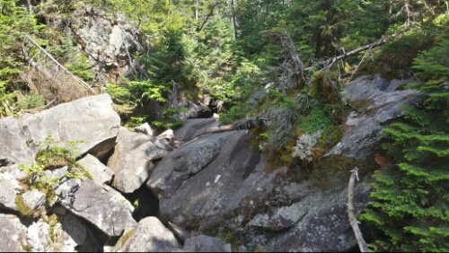
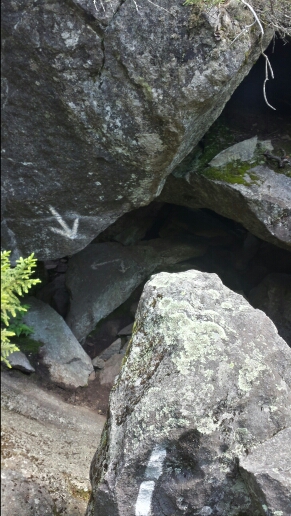
After a morning snack at Full Goose Shelter, we made our way over Fulling Mill Mountain and then descended down to the pit of boulders known as the Mahoosuc Notch. We entered the Notch at 12:05pm and exited it at 1:25pm, so we moved at only 1 mph through it. It was cool at first, but got tiring as we went along. We had to jump between huge boulders, shimmy between them, go under some, go through some small cracks that required taking our packs off, climb up the sides of some, etc.

image

Pile of boulders in the Notch

image

One of numerous boulders to climb under

Once we completed that, the trail immediately starts climbing up the Mahoosuc Arm. This is notorious for being one of the most wicked climbs on the AT and it did not disappoint. It was 1.5 miles of insanely gnarly and difficult terrain and it did not relent for any period of time. We again moved at almost no faster than 1 mph. We originally planned to stop and stay at the shelter less than a mile beyond the summit of the Arm, but it was a bit early, so we pushed on. The next climb up over Old Speck (so many cool mountain names here in Maine) was a shorter one, but also crazy steep and precariously rocky. It was vertigo inducing, but the views were amazing.

image

Old Speck North side

image

Old Speck South side

We continued hiking down towards Grafton Notch. We found a decent spot slightly off the trail a couple tenths of a mile past a stream and called it a day since it was getting late. Maine gave us a nice, wicked, super hard welcome today. Tomorrow we are stopping in our first town in Maine, Andover, for a brief resupply.

Vital stats for Monday, August 25th :
Miles hiked today – 13.3
Mood – good, excited to be hiking in Maine
Physical state – wiped out. These 13 miles feel like 30 miles anywhere else (excluding the Whites)
Smell – getting Mainelier
Song stuck in my head – Mahoosuc (Manic) Monday by The Bangles

Day 131 – US 2 to Carlo Col Shelter (mile 1904)

We grabbed breakfast this morning in town and ran into our old homies from Virginia, Z and Gia. It was cool to see them again. They came into town from Pinkham Notch, meaning they are a couple days of hiking behind us right now. We chatted and then had to hurry to jump on a shuttle we scheduled at 9am to get back to the trail.

The first half of the day was fairly easy hiking, certainly a notch below the difficulty level of the Whites. We had some really cool parting views of the Whites and Mount Washington as we hiked away from them.

image

Whites and Mount Washington off in the distance from Wocket Ledge

The second half things got progressively tougher. The climb up to Mount Success was steep and on many slick rock slabs. The summit area was an interesting above-treeline open swampy thing.

image

Near summit of Mount Success

The descent down included some monster boulders and tough scrambles, which is probably a little preview of tomorrow.

image

Trail? What trail?

And then not long after that, we hit this bad boy.

image

Woooooooooooooooooo! Made it to Maine!

We hiked on for another half mile and then went down and set up on a raised tent platform at the shelter. It’s been very hard to find good stealth campsites lately, so we decided to go against our normal ways and stay at this shelter. This one is pretty nice and our platform is pretty far away from the old guys and their midnight chainsaw snoring machines.

Tomorrow we have probably the single most difficult section of the entire trail, the Mahoosuc Notch. It’s 1.2 miles of bouldering over and around car size boulders. Then we have the supposedly ultra tough Mahoosuc Arm climb immediately after, so we aren’t planning any huge miles.

It feels amazing to be here in Maine, the last state, after so much hiking. I can see the light shimmering and hear the wind whipping on Katahdin in my dreams as we start to draw near to her.

Vital stats for Sunday, August 24th :
Milestone – done with New Hampshire, in Maine now (state 14 of 14). Also, 1900 miles.
Miles hiked today – 17
Mood – so psyched
Physical state – tired after a big tough day with warmer weather than of late
Smell – Mainely
Song stuck in my head – Take A Walk by Passion Pit

Day 130 – Gorham, NH

Today was a nice, long, and relaxing zero day. We figured out how to get on the local bus loop, which was filled with all seemingly jovial old folks, to get out to Walmart to get some random resupply items we wanted. Ahh Walmart, seemingly the one constant near every trail town. After that, we hung out at the local coffee shop and one of the AMC White Mountain hut crews came down on their day off. They amazingly smelled just as bad, if not worse, than many thru-hikers. Impressive. We did some planning for our last few weeks out here this afternoon. We then had some pizza and drinks for dinner and that was about it. Tomorrow morning we are grabbing breakfast and then heading back to the trail. If all goes well, we should have an awesome milestone tomorrow.

Day 129 – mile 1882 to US 2 (mile 1887, Gorham, NH)

We had another night in the Whites with a lousy and super cold and raw campsite, but this one was easier to handle because we knew we had a short day of hiking into town. We climbed down the relatively easy Mount Moriah and descended to an even easier final 2 mile runway to the parking area at US 2. We finished the freaking Whites. It’s crazy because thru-hikers talk about them and how tough they are almost from the start of things way down in the south and now they are done.

We got a shuttle ride to the Libby House B&B in town and then got cleaned up, did laundry, and ate lots of food for lunch and dinner. Gorham seems like another great little town to take a zero day in. Today was really nice and relaxing and we are looking forward to the same thing tomorrow before we get back into the fun on Sunday.

Vital stats for Friday, August 22nd :
Milestone – less than 300 miles away from Katahdin
Miles hiked today – 5
Mood – awesome
Physical state – resting up
Smell – shuttle driver “doc”, who is an actual doctor, said we smelled better than dead bodies. Hopefully still true after showering.
Song stuck in my head – Mason Jar by Smallpools

Day 128 – near Pinkham Notch to mile 1882

After much nicer night in our improved campsite, we got up and almost immediately began the climb up to the Wildcat Mountains. The first trail, up to Wildcat Peak E, was very steep, but didn’t have any major scrambles.

image

Nearly vertical rock on Wildcats

We made it up and ate a snack by the Wildcat ski lift / gondola while a nearby construction dude assembled part of a snowmaking machine. We went over a few of the other Wildcat Peaks and then descended to our last hut, Carter Notch. The crew didn’t have any leftovers, but we managed to barter us carrying a handwritten letter for a large piece of a blueberry cake. One of the girls working at the hut wanted to send a secret letter to the caretaker named “Young Bobby” at a campsite about 7 miles up the trail. I thought it was funny that the workers here in the Whites have to fall back to old school letters to communicate since cell coverage is so bad. We took our leave with the letter to Young Bobby in hand and climbed up Carter Dome. We didn’t think this climb was too bad despite being quite steep, also. We had some other mountains to traverse in the afternoon called the Carter Mountains and one called Height Mountain. We had some great views of the other mountains from them.

image

image

There was a pretty tough climb with a number of scrambles to get down from the Carters. We delivered the letter to the Imp campsite (Young Bobby was not there, but the other caretaker promised to give it to him) and then continued on. We intended to camp below Moriah Mountain, but couldn’t find anything good. We pressed on and climbed over the summit. We had nice late evening views as we went over it.

image

Moriah Mountain view

We found a tight camp spot part way down the descent. We are now roughly 5 miles from Gorham and are pretty much done with the Whites. Craziness.

Vital stats for Thursday, August 21st :
Miles hiked today – 15.8
Mood – psyched that we got through the Whites, excited to have time off tomorrow and Saturday to recover
Physical state – beat, without a doubt this has been our hardest section of the AT thus far and there’s not even a remotely close second
Smell – Outback bloomin’ onion soaked in ammonia and vinegar
Song stuck in my head – Don’t You (Forget About Me) by Simple Minds

Day 127 – near Mount Clay to near Pinkham Notch (mile 1866.2)

We departed our crummy campsite after a not so great night of sleep (due to the crumminess) around 7. We climbed the mile back up to the Northern Presidential Ridge and continued trekking away from Mount Washington. We could hear the sounds of the sightseeing “cog” train every so often. We had some nice morning sun and great weather again all day.

image

Morning sun coming over the Presidential Ridge

image

Clouds down in the valley below us

The trail snaked up and down the ridge past Mount Jefferson, numerous Mount Adams, and other probably crappier president’s mountains. There were many huge rocks to hop over and across, so our pace was pretty slow. The views were just as stunning as yesterday as we finished the climb over Mount Madison and descended off the massive and steep ridge finally around lunch. It feels like you’re on top of the world up on that ridge.

image

Trail approaching Mt. Madison

image

Ravine and mountains off to the northwest

After we got off the ridge, we hiked through part of the Great Gulf Wilderness. Then we crossed the Mt. Washington auto road and hiked down to Pinkham Notch. We stopped at the visitor center for a snack and grabbed our maildrop. Then we hiked on for another quarter mile or so and found a really pleasant campsite tucked back a couple hundred yards from the trail. Another really great day here in the Whites. Tomorrow morning we climb the extremely steep Wildcats, but we are nearly complete with the Whites.

Vital stats for Wednesday, August 20th :
Miles hiked today – 12.4 (plus bonus mile from Jewell Trail campsite)
Mood – awesome
Physical state – good
Smell – 5 days of tough hiking… Wretched onions
Song stuck in my head – Meow! Meow! Space Tiger by Rx Bandits

Day 126 – near Kedron Flume Trail to near Mount Clay (mile 1853.8)

We had a very nice and uneventful night. No puddles and no rain! We got up and descended down to Crawford Notch, crossed route 302, and then began the 12+ mile terraced ascent up to Mount Washington. The first climb was up to Webster Cliffs. It was very steep and had a few scrambles, but didn’t slow us down much. There were some great views off of it.

image

We kept going up and up. Some of the climbs had big scrambles and were slow, some were pretty gentle for the Whites. We made our way to the first hut of the day, Mizpah Springs, and stopped for a snack. Score, they had leftover chicken, couscous, rice pudding, etc. We helped them with a few super easy chores like sorting some recycling from the guests in return, as is the custom for thru-hikers. We met another thru-hiker named 6 slash from Bethlehem, which was cool and random. After that, we got up and above tree line. This time, unlike the other day, it was epic in a good way. We had views literally all day as we kept going up to Washington.

image

image

image

We then made it to the next hut, Lake of the Clouds.

image

Lake of the Clouds Hut

We stopped in for a break, but didn’t attempt to get any extra food as it was crazy full of people.

Next, we ascended to Washington. The final climb of 1.3 miles was rocky, but not too bad considering the rest of the trail here. It was a bit cloudy up there. It was also a circus, with seemingly millions of tourists milling about from their cars, the train, hot air balloons, escalators, elevators, and whatever other means there are to getting up there. We stopped in the snack bar and ate more, but left shortly after.

The views continued to be amazing on the north side of the mountain.

image

Great Gulf Wilderness

image

We continued on to a side trail called the Jewell trail and took it down almost a mile to get back to under the tree line to camp. We found a crummy spot down there that we grudgingly took, but we can’t sleep up above tree line and we have a lot of miles left on the AT before we descend below it tomorrow. That kind of sucked, but oh well.

Really a fantastic day of hiking with spectacular weather and views. We could see some of the peaks in western Maine looming off in the not too far distance, so that was absolutely thrilling to see for the first time, too.

Vital stats for Tuesday, August 19th :
Miles hiked today – 15.3 (plus bonus mile down Jewell Trail to get under tree line)
Mood – excellent, fantastic day in the Whites
Physical state – the Whites are tiring!
Smell – criminal
Song stuck in my head – Shine by Wild Belle

Day 125 – near Garfield Pond to near Kedron Flume Trail (mile 1838.5)

After the rough day yesterday, we were awoken even more roughly around 4am by the encroachment of a large puddle in our sleeping area. Ugh, we slept in a basin in the pseudo-established site we were in. That was totally a horrible way to start the day. It poured for a good chunk of the night when the forecast said it was supposed to be mostly dry. We should have known to not trust the forecast here in the Whites. We were mostly dry, but some clothes, our sleeping pads, and some other gear was wet. By 5 or so, we decided to just get up and get moving and dry our stuff out later. The trail was misty and raw and cold, so it was a pretty miserable morning. We climbed Mount Garfield to no views again because of the seemingly constant cloud we were in.

image

Mount Garfield view

The descent, as usual, was really slow, slick, and tough. We had multiple minor slips and falls going down. The trail is so insanely rugged here compared to the rest of the AT.

After we got over that, we started the climb up the big mountain of the day, South Twin. Part of the way up though there is a hut named Galehead. Our day got considerably better from this point on I’m happy to report. We went in, warmed up, and bought some hot coffee, cake, carrot bread, and soup from the hut. This was amazing after being frozen, wet, and cold. We then headed up South Twin. The climb wasn’t too bad as far as the Whites go (meaning it’s still harder than pretty much everything else). Also, the clouds started to break up. We saw the sun finally. We rejoiced triumphantly like we had something to do with it! The mist blew out and finally saw why so many people said they love the Whites (we were really really really starting to hate them). We climbed the smaller Mount Guyot to amazing views.

image

So these are the rumored Whites

image

Summit of Mount Guyot with open ridge above tree line snaking away

It was spectacular. We also had enough sun to mostly dry all our wet crap out at lunch.

We then gradually descended to the next hut at Zealand Falls. Trippy asked them about leftovers from last night and they gave us a giant platter of stuffed shells. They were super nice. They sometimes give these to thru-hikers so they don’t have to pack it out and hike it out in their trash. What a great “snack”, 1000 or more calories of super cheesy pasta.

To make things even nicer, we had a good 6 mile stretch or so with easy trail after that hut. After having so much difficult trail in the past few days, it was more than welcome.

Tomorrow we summit Mount Washington, the second highest peak on the trail behind only Clingman’s Dome, which we did way back in early May in the Smokies.

image

Mount Washington looming in the back

We found a very stealthy site that is not in a basin a couple hundred yards off the trail on the descent down to Crawford Notch.

Vital stats for Monday, August 18th :
Miles hiked today – 17.3
Mood – so glad the weather and the day turned for the better
Physical state – beat from the tough trails, but good
Smell – week old turkey sandwich
Song stuck in my head – Here Comes The Sun by The Beatles

Day 124 – mile 1808.6 to near Garfield Pond (mile 1821.2)

We had some rain showers last night, so everything was cold and damp this morning. The Whites seem to be very damp almost all of the time from what we’ve seen thus far. We got up and hiked down to Lonesome Lake and the hut that is there. Lots of people who stayed at the hut were milling about as we grabbed some potable water and went on our way.

image

Lonesome Lake with funky reflection

We descended down to Franconia Notch and went under I-93. Then we began the big climb of the day, up to Franconia Ridge. This was a steep and arduous hike. It wasn’t a scramble like Kinsman, but it was rocky, long, and hard. It was a little misty, cold, and windy as we hiked up onto the ridge. We got up to the 2 mile long open ridge above the tree line around 1pm or so. It was foggy and we were in a cloud without any views, but fine otherwise.

image

Cairn and Trippy off in the cloud

image

Rock scrambles up near Mount Lincoln

As we got closer to the end of the open Franconia Ridge near Mount Lafayette, the rain picked up. Then shortly after that, the wind got intense. Then we started to get some small hail or sleet or something similar, too. I usually ask former thru-hikers what their least favorite section is (along with their favorite), and a number answered with, “The Whites, if you have bad weather”. I get it now. It was freaking atrocious up there in the storm. It was super cold and the wind gusts were blasting us around (and there isn’t a lot of room to get blasted up there without flying off the cliffs). It was intensely powerful and scary and it came on so fast we literally had no time at all to get out of it. We were fairly lucky that we weren’t too far from the tree line. We moved as fast as we could, which wasn’t fast at all, to get down and under some cover. The rain was blowing sideways, so it was impossible to stay dry. The wind was whipping really hard (AMC caretaker said ~60 mph) and it was in the 40’s up there, so once we got wet my fear was hypothermia. We kept moving though and stayed warm enough. It definitely got a lot better once we were below the tree line again. We hiked on for a few more miles, but called it an early day to dry out and warm back up (nothing like some delicious Ramen noodles to heat the hypothermia out of your body!).

Tomorrow we are hoping for some clear weather and to make up a few miles. So far the Whites have been quite a test.

Vital stats for Sunday, August 17th :
Miles hiked today – 12.6
Mood – glad to be warmed back up, hopeful we don’t have to deal with that kind of weather again
Physical state – ok, no major problems
Smell – unclear, nose froze off, only two semi-useless holes left on face where nose used to be
Song stuck in my head – none today, too much wind!